Best GIS Software
Demographic data is key to any business today. Knowing where your customers come from, understanding your peak business location, and unleashing the hidden opportunities are critical to surviving in a competitive business setting. A geographic information system software or a GIS system is capable of gathering and analyzing information effortlessly. GIS mapping software encompasses various functional features that integrate different sets of data. An efficient GIS tool can reveal more in-depth insights into the data by drawing multiple patterns, and predictive models enabling users to make better and smarter decisions. The following list of GIS software solutions includes some of the best GIS Software available in the market.
List of Geographic Information System (GIS) Software | Best GIS Mapping Software
-
![Maptitude]()
Maptitude Geographic Information System (GIS) software gives you the tools, maps, and demographic data you need to analyze and understand how geography affects you and your business. Every day you have to ... read more about Maptitude
Entry Level Price$695 One-timeFree TrialAvailablePricing TypeFlat Rate100% in GIS SoftwareFeatures
- 3D Visualization
- Colour Coding
- Data Analysis
- Geo-coding
- Image Management
- Labeling
- Mapping Tools
- Navigation Services
- Remote Sensing
- Spatial Analysis
Key Details
Licensing & Deployment
-
Cloud Hosted
-
Windows
Support
- Phone
Knowledge Base
-
Help Guides
-
Video Guides
-
Case Studies
-
On-Site Training
Packages
Pricing Type
-
Flat Rate
Free Version
-
No
Payment Frequency
-
One-Time Payment
Available Packages
Standard$695 One-time -
![ArcGIS]()
Integrated collection of GIS software products; ArcGIS offers unique capabilities and flexible licensing for applying location-based analytics to your business practices. Gain greater insights using contextual tools to visualize and analyze your ... read more about ArcGIS
Entry Level PriceContact vendorFree TrialAvailablePricing TypeContact Vendor50% in GIS SoftwareFeatures
- 3D Visualization
- Colour Coding
- Data Analysis
- Image Management
- Mapping Tools
- Remote Sensing
- Spatial Analysis
Key Details
Industries
-
Architecture-planning
-
Education-management
-
Facilities-services
-
Government-relations
-
Health-wellness-fitness
-
Hospital-health-care
-
Nonprofit-organization-management
-
Oil-energy
-
Utilities
Licensing & Deployment
-
Proprietary
-
Cloud Hosted
-
On Premises
-
Web-based
-
iPhone/iPad
-
Android
-
Windows
-
Linux
Support
- Phone
-
24x7 Support
Knowledge Base
-
Help Guides
-
Video
-
Blog
Packages
Pricing Type
-
Contact Vendor
Preferred Currency
-
USD ($)
Free Version
-
No
Free Trial
-
Available Trial
Payment Frequency
-
Quote Based
-
![Maptive]()
Our mapping software helps you transform your spreadsheet data into a customized Google Map in seconds. Simply sign up, load your location-based data, and we will do the rest. Once your data ... read more about Maptive
Entry Level Price$1250 Per YearFree TrialAvailablePricing TypeFlat Rate50% in GIS SoftwareFeatures
- 3D Visualization
- Colour Coding
- Data Analysis
- Geo-coding
- Image Management
- Mapping Tools
- Navigation Services
Key Details
Licensing & Deployment
-
Cloud Hosted
-
Web-based
Support
- Phone
Knowledge Base
-
Help Guides
-
Blogs
-
Case Studies
Packages
Pricing Type
-
Flat Rate
Free Version
-
No
Free Trial
-
Available Trial
Payment Frequency
-
Annual Subscription
Available Packages
Standard$1250 Per Year -
![Grass GIS]()
GRASS GIS, commonly referred to as GRASS (Geographic Resources Analysis Support System), is a free and open source Geographic Information System (GIS) software suite used for geospatial data management and analysis, image ... read more about Grass GIS
Entry Level PriceFree versionFree TrialAvailablePricing TypeFree100% in GIS SoftwareFeatures
- 3D Visualization
- Colour Coding
- Data Analysis
- Geo-coding
- Image Management
- Diagramming
- Mapping Tools
- Spatial Analysis
Key Details
Licensing & Deployment
-
Windows
-
Mac
-
Linux
Knowledge Base
-
Help Guides
-
Video Guides
-
On-Site Training
Packages
Pricing Type
-
Free
Payment Frequency
-
Free
-
![QGIS]()
QGIS is a professional GIS application that is built on top of and proud to be itself Free and Open Source Software (FOSS). Create, edit, visualize, analyze, and publish geospatial information on ... read more about QGIS
Entry Level PriceFree versionFree TrialAvailablePricing TypeFree100% in GIS SoftwareFeatures
- 3D Visualization
- Colour Coding
- Data Analysis
- Geo-coding
- Image Management
- Mapping Tools
- Spatial Analysis
Key Details
Licensing & Deployment
-
Web-based
-
Android
-
Windows
-
Mac
-
Linux
Knowledge Base
-
Help Guides
-
Blogs
-
Case Studies
-
On-Site Training
Packages
Pricing Type
-
Free
Payment Frequency
-
Free
-
![MapInfo Pro]()
Desktop solution that helps businesses easily visualize the relationships between data and geography through location analytics.
Entry Level PriceContact vendorFree Trial30 DaysPricing TypeContact Vendor100% in GIS SoftwareFeatures
- Data Analysis
- Geo-coding
- Mapping Tools
- Spatial Analysis
Key Details
Licensing & Deployment
-
Cloud Hosted
-
Windows
Support
- Chat
- Phone
Knowledge Base
-
Help Guides
-
Video Guides
-
Blogs
Packages
Pricing Type
-
Contact Vendor
Free Version
-
No
Free Trial
-
30 Days Trial
Payment Frequency
-
Quote Based
-
![SAGA GIS]()
SAGA's first objective is to give (geo-)scientists an effective but easy learnable platform for the implementation of geoscientific methods. This is achieved by SAGA's unique Application Programming Interface (API). The second is ... read more about SAGA GIS
Entry Level PriceFree versionFree TrialAvailablePricing TypeFree100% in GIS SoftwareFeatures
- Colour Coding
- Data Analysis
- Geo-coding
- Image Management
- Mapping Tools
- Navigation Services
- Spatial Analysis
Key Details
Licensing & Deployment
-
Cloud Hosted
-
Web-based
Knowledge Base
-
Help Guides
Packages
Pricing Type
-
Free
Payment Frequency
-
Free
-
![Simple GIS Software]()
Simple GIS Client is a feature rich Microsoft Windows based GIS software application. Simple GIS is powerful enough to run as a fully functional Desktop GIS Software application but lightweight enough to ... read more about Simple GIS Software
Entry Level PriceContact vendorFree Trial15 DaysPricing TypeFlat Rate100% in GIS SoftwareFeatures
- Colour Coding
- Data Analysis
- Geo-coding
- Image Management
- Diagramming
- Mapping Tools
- Navigation Services
- Spatial Analysis
Key Details
Industries
-
Civil-engineering
-
Commercial-real-estate
-
Computer-software
-
Education-management
-
Environmental-services
-
Farming
-
Government-administration
-
Health-wellness-fitness
-
Hospital-health-care
-
Law-enforcement
-
Market-research
-
Mining-metals
-
Oil-energy
-
Real-estate
-
Recreational
-
Religious-institutions
-
Renewables-environment
-
Research
-
Telecommunications
-
Transportation-trucking-railroad
-
Utilities
Licensing & Deployment
-
Proprietary
-
On Premises
-
Windows
Support
- Email
-
Weekdays
Training
-
Webinar
-
Documentation
Knowledge Base
-
Help Guides
-
Video Guides
-
Case Studies
Packages
Pricing Type
-
Flat Rate
Preferred Currency
-
USD ($)
Free Version
-
No
Free Trial
-
15 Days Trial
Payment Frequency
-
One-Time Payment
-
![GeoMedia]()
Cloud-based and on-premise GIS management platform that helps users aggregate and access geospatial data for processing, analysis, presentation and sharing with unified map view.
Entry Level PriceContact vendorFree TrialN/APricing TypeContact Vendor100% in GIS SoftwareFeatures
- 3D Visualization
- Colour Coding
- Data Analysis
- Diagramming
- Mapping Tools
- Spatial Analysis
Key Details
Licensing & Deployment
-
Cloud Hosted
-
Windows
Support
- Phone
Knowledge Base
-
Help Guides
-
Video Guides
-
Blogs
-
Case Studies
-
Whitepapers
-
On-Site Training
Packages
Pricing Type
-
Contact Vendor
Free Version
-
No
Payment Frequency
-
Quote Based
-
![OpenCities Map]()
Full-featured GIS designed to address the unique and challenging needs of organizations that map, plan, design, build, and operate the world's infrastructure.
Entry Level PriceContact vendorFree TrialN/APricing TypeContact Vendor100% in GIS SoftwareFeatures
- 3D Visualization
- Data Analysis
- Image Management
- Mapping Tools
- Spatial Analysis
Key Details
Licensing & Deployment
-
Cloud Hosted
-
Web-based
-
iPhone/iPad
-
Android
Support
- Phone
Knowledge Base
-
Help Guides
-
Video Guides
-
Case Studies
Packages
Pricing Type
-
Contact Vendor
Free Version
-
No
Payment Frequency
-
Quote Based
-
![gvSIG]()
gvSig Desktop is easy to work in a variety of formats, vector and raster files, databases and remote services. There are always available all kinds of tools to analyze and manage your ... read more about gvSIG
Entry Level PriceFree versionFree TrialAvailablePricing TypeFree100% in GIS SoftwareFeatures
- 3D Visualization
- Colour Coding
- Data Analysis
- Image Management
- Diagramming
- Mapping Tools
- Navigation Services
- Remote Sensing
Key Details
Licensing & Deployment
-
Android
-
Windows
-
Linux
Knowledge Base
-
Help Guides
-
Video Guides
-
Case Studies
Packages
Pricing Type
-
Free
Payment Frequency
-
Free
-
![Map Business Online]()
Map Business Online is a cloud business mapping software used by a large variety of businesses to organize and analyze their business data geographically. This map software can be used by any ... read more about Map Business Online
Entry Level Price$600.00 Per YearFree Trial30 DaysPricing TypeFlat Rate50% in GIS SoftwareFeatures
- Colour Coding
- Data Analysis
- Image Management
- Mapping Tools
- Spatial Analysis
Key Details
Licensing & Deployment
-
Cloud Hosted
-
Web-based
-
Windows
-
Mac
Support
- Phone
Knowledge Base
-
Help Guides
-
Video Guides
-
Blogs
-
Case Studies
Packages
Pricing Type
-
Flat Rate
Free Version
-
No
Free Trial
-
30 Days Trial
Payment Frequency
-
Annual Subscription
Available Packages
Standard$600.00 Per Year -
![MAPublisher]()
MAPublisher® cartography software seamlessly integrates more than fifty GIS mapping tools into Adobe Illustrator to help you create beautiful maps. Import industry-standard GIS data formats and make crisp, clean maps with all ... read more about MAPublisher
Entry Level Price$499 One-timeFree Trial14 DaysPricing TypeFlat Rate100% in GIS SoftwareFeatures
- Colour Coding
- Data Analysis
- Image Management
- Diagramming
- Mapping Tools
- Spatial Analysis
Key Details
Licensing & Deployment
-
On Premises
-
Windows
-
Mac
Support
- Phone
Knowledge Base
-
Help Guides
-
Video Guides
-
Blogs
-
Webinars
-
On-Site Training
Packages
Pricing Type
-
Flat Rate
Free Version
-
No
Free Trial
-
14 Days Trial
Payment Frequency
-
One-Time Payment
Available Packages
Standard$499 One-time -
![eSpatial]()
eSpatial delivers powerful mapping in minutes. With eSpatial mapping software you can easily upload and visualize multiple layers of data. Quickly create dynamic reports. Analyze key areas and share results. It's rapid ... read more about eSpatial
Entry Level Price$1295 Per YearFree TrialAvailablePricing TypeFlat Rate50% in GIS SoftwareFeatures
- 3D Visualization
- Colour Coding
- Data Analysis
- Image Management
- Labeling
- Mapping Tools
- Navigation Services
- Spatial Analysis
Key Details
Licensing & Deployment
-
Cloud Hosted
-
Web-based
-
iPhone/iPad
-
Android
Support
- Chat
- Phone
Knowledge Base
-
Help Guides
-
Blogs
-
Webinars
-
Case Studies
Packages
Pricing Type
-
Flat Rate
Free Version
-
No
Payment Frequency
-
Annual Subscription
-
Quote Based
Available Packages
Standard$1295 Per Year -
![ENVI]()
ENVI image analysis software is used by GIS professionals, remote sensing scientists, and image analysts to extract meaningful information from imagery to make better decisions. ENVI can be deployed and accessed from ... read more about ENVI
Entry Level PriceContact vendorFree TrialN/APricing TypeContact Vendor100% in GIS SoftwareFeatures
- Colour Coding
- Data Analysis
- Image Management
- Mapping Tools
- Remote Sensing
- Spatial Analysis
Key Details
Licensing & Deployment
-
Cloud Hosted
-
Web-based
-
Android
-
Windows
Support
- Phone
Knowledge Base
-
Help Guides
-
Video Guides
-
Blogs
-
Case Studies
-
Whitepapers
-
On-Site Training
Packages
Pricing Type
-
Contact Vendor
Free Version
-
No
Payment Frequency
-
Quote Based
-
![Cadcorp]()
It has been designed to meet the needs of end-users and application developers alike, for use in all phases of spatial data management - from creation, through to application development, deployment and ... read more about Cadcorp
Entry Level PriceFree versionFree TrialAvailablePricing TypeFree100% in GIS SoftwareFeatures
- 3D Visualization
- Colour Coding
- Data Analysis
- Image Management
- Diagramming
- Mapping Tools
- Navigation Services
- Spatial Analysis
Key Details
Licensing & Deployment
-
Cloud Hosted
-
Web-based
-
Android
-
Windows
-
Mac
Support
- Phone
Knowledge Base
-
Help Guides
-
Video Guides
-
Blogs
-
Webinars
-
Case Studies
Packages
Pricing Type
-
Free
Payment Frequency
-
Quote Based
-
Free
-
![CartoVista]()
An interactive map is worth a million words. With CartoVista, discover your data hidden meaning and transform it into rich visual content. Start from your spreadsheet or GIS data, configure it and ... read more about CartoVista
Entry Level PriceContact vendorFree TrialAvailablePricing TypeContact Vendor100% in GIS SoftwareFeatures
- Colour Coding
- Data Analysis
- Image Management
- Diagramming
- Mapping Tools
- Spatial Analysis
Key Details
Licensing & Deployment
-
Cloud Hosted
-
Web-based
-
Windows
Support
- Phone
Knowledge Base
-
Help Guides
-
Video Guides
Packages
Pricing Type
-
Contact Vendor
Free Version
-
No
Payment Frequency
-
Quote Based
-
![TerraSync Software]()
Trimble® TerraSync™ software is designed for fast and efficient field GIS data collection and maintenance. Simple, efficient, and productive in the field, TerraSync software is the clear choice for collecting and maintaining ... read more about TerraSync Software
Entry Level PriceContact vendorFree TrialN/APricing TypeContact Vendor100% in GIS SoftwareFeatures
- Colour Coding
- Data Analysis
- Mapping Tools
- Spatial Analysis
Key Details
Licensing & Deployment
-
On Premises
-
Windows
Support
- Phone
Knowledge Base
-
Help Guides
-
Blogs
-
Webinars
-
Case Studies
Packages
Pricing Type
-
Contact Vendor
Free Version
-
No
Payment Frequency
-
One-Time Payment
-
![MB&G MobileMap]()
MB&G provides software products and services focused on meeting the challenges of real-world natural resource management.
Entry Level Price$25 Per MonthFree TrialAvailablePricing TypeFlat Rate100% in GIS SoftwareFeatures
- Data Analysis
- Image Management
- Mapping Tools
- Navigation Services
Key Details
Licensing & Deployment
-
Cloud Hosted
-
Web-based
-
Android
Support
- Phone
Knowledge Base
-
Help Guides
Packages
Pricing Type
-
Flat Rate
Free Version
-
No
Payment Frequency
-
Monthly Payment
-
Annual Subscription
Available Packages
Standard$25 Per Month -
![gisAMPS]()
gisAMPS is our geographic information systems viewer. It provides mapping capability that can be combined with any of the geoAMPS suite of industry-specific products to provide an intuitive view that is compliant ... read more about gisAMPS
Entry Level PriceContact vendorFree TrialN/APricing TypeContact Vendor100% in GIS SoftwareFeatures
- 3D Visualization
- Colour Coding
- Data Analysis
- Mapping Tools
- Spatial Analysis
Key Details
Licensing & Deployment
-
Cloud Hosted
-
On Premises
-
Web-based
-
Windows
-
Mac
Support
- Phone
Knowledge Base
-
Help Guides
-
Webinars
-
Case Studies
Packages
Pricing Type
-
Contact Vendor
Free Version
-
No
Payment Frequency
-
Monthly Payment
-
One-Time Payment
-
![SuperGIS Desktop]()
SuperGIS Desktop is geographic information system (GIS) software for creating, visualizing, managing, and analyzing geospatial data. By using SuperGIS Desktop, you can easily process various geographic phenomena and make smarter decisions.
Entry Level PriceContact vendorFree Trial30 DaysPricing TypeContact Vendor100% in GIS SoftwareFeatures
- Colour Coding
- Data Analysis
- Diagramming
- Mapping Tools
- Navigation Services
- Spatial Analysis
Key Details
Licensing & Deployment
-
On Premises
-
Windows
Support
- Phone
Knowledge Base
-
Help Guides
-
Webinars
Packages
Pricing Type
-
Contact Vendor
Free Version
-
No
Free Trial
-
30 Days Trial
Payment Frequency
-
Quote Based
-
![Geolytics]()
Demographic data that is current, convenient and comprehensive at affordable prices.
Entry Level PriceContact vendorFree TrialN/APricing TypeContact Vendor100% in GIS SoftwareFeatures
- Colour Coding
- Geo-coding
- Mapping Tools
- Spatial Analysis
Key Details
Licensing & Deployment
-
Cloud Hosted
-
Web-based
Support
- Phone
Knowledge Base
-
Help Guides
Packages
Pricing Type
-
Contact Vendor
Free Version
-
No
Payment Frequency
-
Quote Based
-
![Mango]()
Transforming your data into interactive web maps that empower clients, colleagues, and communities has never been simpler. No Coding, No Servers, No Complex Licencing.
Entry Level Price$49 Per MonthFree Trial30 DaysPricing TypeFlat Rate100% in GIS SoftwareFeatures
- Colour Coding
- Data Analysis
- Geo-coding
- Image Management
- Diagramming
- Mapping Tools
- Spatial Analysis
Key Details
Licensing & Deployment
-
Cloud Hosted
-
Web-based
Support
- Phone
Knowledge Base
-
Help Guides
-
Video Guides
-
Case Studies
-
On-Site Training
Packages
Pricing Type
-
Flat Rate
Free Version
-
No
Free Trial
-
30 Days Trial
Payment Frequency
-
Monthly Payment
-
Annual Subscription
Available Packages
Standard$49 Per Month -
![SuperMap Desktop GIS]()
SuperMap Desktop GIS is designed for any GIS users regardless you are a casual mapmaker or a seasonal professionals. It's a ready- and easy-to-use GIS software in Microsoft Office style, and provides ... read more about SuperMap Desktop GIS
Entry Level PriceContact vendorFree TrialMore than 30 daysPricing TypeContact Vendor100% in GIS SoftwareFeatures
- 3D Visualization
- Colour Coding
- Data Analysis
- Image Management
- Diagramming
- Mapping Tools
- Spatial Analysis
Key Details
Licensing & Deployment
-
On Premises
-
iPhone/iPad
-
Android
-
Windows
-
Mac
Support
- Phone
Knowledge Base
-
Help Guides
-
Video Guides
-
Case Studies
-
On-Site Training
Packages
Pricing Type
-
Contact Vendor
Free Version
-
No
Free Trial
-
More than 30 days Trial
Payment Frequency
-
One-Time Payment
-
![GeoExpress]()
The massive, high-definition imagery used throughout the geospatial industry provides invaluable insights, but huge file sizes can make sharing, viewing, and manipulating this data extremely challenging. GeoExpress enables geospatial professionals to compress ... read more about GeoExpress
Entry Level PriceContact vendorFree Trial30 DaysPricing TypeContact Vendor100% in GIS SoftwareFeatures
- Data Analysis
- Image Management
- Spatial Analysis
Key Details
Licensing & Deployment
-
On Premises
-
Windows
Knowledge Base
-
Help Guides
-
Video Guides
-
Blogs
-
Case Studies
Packages
Pricing Type
-
Contact Vendor
Free Version
-
No
Free Trial
-
30 Days Trial
Payment Frequency
-
Quote Based
-
![AziMap]()
Create the maps that matter to your business. Capture, store, integrate and manipulate various layers of spatial data on a single map, using Azimap web GIS.
Entry Level Price$49 Per MonthFree Trial30 DaysPricing TypeFlat Rate100% in GIS SoftwareFeatures
- Data Analysis
- Geo-coding
- Mapping Tools
- Spatial Analysis
Key Details
Licensing & Deployment
-
Cloud Hosted
-
Web-based
-
iPhone/iPad
-
Android
-
Windows
-
Mac
Support
- Phone
Knowledge Base
-
Help Guides
Packages
Pricing Type
-
Flat Rate
Free Version
-
No
Free Trial
-
30 Days Trial
Payment Frequency
-
Monthly Payment
-
Annual Subscription
Available Packages
Standard$49 Per Month -
![GeoComm Dispatch Map]()
Innovative software platform that provides a more accurate location of 911 emergency callers. Design specifically based on user feedback and tailored to include dispatch preferences, This software supports & enhances your 911 ... read more about GeoComm Dispatch Map
Entry Level PriceContact vendorFree TrialN/APricing TypeContact Vendor100% in GIS SoftwareFeatures
- 3D Visualization
- Colour Coding
- Data Analysis
- Mapping Tools
- Navigation Services
- Spatial Analysis
Key Details
Licensing & Deployment
-
Cloud Hosted
-
Windows
-
Mac
Support
- Phone
Knowledge Base
-
Help Guides
-
Video Guides
-
Blogs
Packages
Pricing Type
-
Contact Vendor
Free Version
-
No
Payment Frequency
-
Quote Based
-
![EDAMS GIS Systems]()
The EDAMS GIS modules offers the EDAMS user a cost effective and efficient solution by providing links to the most popular GIS systems by ESRI, provides seamless GIS integration for all EDAMS ... read more about EDAMS GIS Systems
Entry Level PriceContact vendorFree TrialN/APricing TypeContact Vendor100% in GIS SoftwareFeatures
- Colour Coding
- Data Analysis
- Geo-coding
- Image Management
- Diagramming
- Mapping Tools
- Spatial Analysis
Key Details
Licensing & Deployment
-
Cloud Hosted
-
Windows
Support
- Phone
Knowledge Base
-
Help Guides
-
Video Guides
-
Case Studies
Packages
Pricing Type
-
Contact Vendor
Free Version
-
No
Payment Frequency
-
Quote Based
-
![GEOCIRRUS]()
GEOCIRRUS delivers spatial information, tools and applications to help you make better decisions. Stream content, analyse patterns, solve problems and share your ideas and maps, all from your web browser or mobile ... read more about GEOCIRRUS
Entry Level PriceContact vendorFree TrialN/APricing TypeContact Vendor100% in GIS SoftwareFeatures
- 3D Visualization
- Data Analysis
- Image Management
- Mapping Tools
- Spatial Analysis
Key Details
Licensing & Deployment
-
Cloud Hosted
-
Web-based
-
iPhone/iPad
-
Android
Knowledge Base
-
Help Guides
-
Video Guides
-
Case Studies
Packages
Pricing Type
-
Contact Vendor
Free Version
-
No
Payment Frequency
-
Quote Based
-
![iMapBuilder]()
Create an interactive HTML5 map for presentation or data visualization with just a few clicks. Easily pinpoint locations, add routes, rollover and zoom effects. Embed your responsive map on website or share ... read more about iMapBuilder
Entry Level Price$99 One-timeFree TrialAvailablePricing TypeFlat Rate100% in GIS SoftwareFeatures
- Colour Coding
- Data Analysis
- Image Management
- Diagramming
- Mapping Tools
Key Details
Licensing & Deployment
-
On Premises
-
Windows
-
Mac
-
Linux
Knowledge Base
-
Help Guides
-
Video Guides
-
Blogs
Packages
Pricing Type
-
Flat Rate
Free Version
-
No
Payment Frequency
-
One-Time Payment
Available Packages
Standard$99 One-time -
![Indshine]()
Indshine simplifies working on drone data with a central place for visualisation and team collaboration.
Entry Level PriceFree versionFree TrialAvailablePricing TypeFree100% in GIS SoftwareFeatures
- 3D Visualization
- Data Analysis
- Image Management
- Mapping Tools
- Spatial Analysis
Key Details
Licensing & Deployment
-
Cloud Hosted
-
Web-based
Support
- Chat
Knowledge Base
-
Help Guides
-
Blogs
-
Case Studies
Packages
Pricing Type
-
Free
Payment Frequency
-
Monthly Payment
-
Free
-
![Touch GIS]()
Powerful mobile devices are transforming how we work in the field. Touch GIS takes full advantage of the device you already have in your pocket, making field data collection easier than ever. ... read more about Touch GIS
Entry Level Price$299.99 Per YearFree Trial14 DaysPricing TypeFlat Rate100% in GIS SoftwareFeatures
- Colour Coding
- Data Analysis
- Image Management
- Diagramming
- Mapping Tools
- Navigation Services
Key Details
Licensing & Deployment
-
Cloud Hosted
-
iPhone/iPad
Knowledge Base
-
Help Guides
-
Video Guides
Packages
Pricing Type
-
Flat Rate
Free Version
-
No
Free Trial
-
14 Days Trial
Payment Frequency
-
Annual Subscription
Available Packages
Standard$299.99 Per Year -
![Global Mapper]()
Now in its third decade of development, Global Mapper continues to cause a stir in the worldwide geospatial community. From its humble beginnings as a simple data viewing utility, it has evolved ... read more about Global Mapper
Entry Level Price$549 One-timeFree TrialN/APricing TypeFlat Rate100% in GIS SoftwareFeatures
- 3D Visualization
- Data Analysis
- Geo-coding
- Image Management
- Mapping Tools
- Navigation Services
- Spatial Analysis
Key Details
Licensing & Deployment
-
On Premises
-
Windows
-
Mac
Support
- Phone
Knowledge Base
-
Help Guides
-
Video Guides
-
Blogs
-
Webinars
-
Case Studies
-
On-Site Training
Packages
Pricing Type
-
Flat Rate
Free Version
-
No
Payment Frequency
-
One-Time Payment
Available Packages
Standard$549 One-time -
![TatukGIS]()
The TatukGIS Editor is a professional, general purpose desktop GIS data editor and mapping application with built-in scripting environment for customization and feature extensions. The free TatukGIS Viewer is the same as ... read more about TatukGIS
Entry Level Price$2990 One-timeFree TrialAvailablePricing TypeFlat Rate100% in GIS SoftwareFeatures
- 3D Visualization
- Colour Coding
- Geo-coding
- Image Management
- Diagramming
- Mapping Tools
- Navigation Services
- Spatial Analysis
Key Details
Licensing & Deployment
-
On Premises
-
iPhone/iPad
-
Android
-
Windows
-
Mac
-
Linux
Support
- Phone
Knowledge Base
-
Help Guides
-
Blogs
-
Case Studies
-
On-Site Training
Packages
Pricing Type
-
Flat Rate
Free Version
-
No
Payment Frequency
-
One-Time Payment
Available Packages
Standard$2990 One-time -
![ERDAS IMAGINE]()
ERDAS IMAGINE provides true value, consolidating remote sensing, photogrammetry, LiDAR analysis, basic vector analysis, and radar processing into a single product. We offer many solutions in one.
Entry Level PriceContact vendorFree TrialN/APricing TypeContact Vendor100% in GIS SoftwareFeatures
- 3D Visualization
- Data Analysis
- Image Management
- Mapping Tools
- Remote Sensing
- Spatial Analysis
Key Details
Licensing & Deployment
-
Cloud Hosted
-
Windows
Support
- Phone
Knowledge Base
-
Help Guides
-
Video Guides
-
Blogs
-
Case Studies
-
Whitepapers
-
On-Site Training
Packages
Pricing Type
-
Contact Vendor
Free Version
-
No
Payment Frequency
-
Quote Based


- 1
- 2
Why Trust Goodfirms
Goodfirms is the world’s leading reviews and ratings company featuring 110,000+ tech companies from across the globe, complete with 80,000+ humanly vetted client reviews, detailed portfolios, hourly rates, employee strength, and more to help you choose your perfect tech partner.
Humanly-Vetted Client Reviews
Our researchers have personally vouched for the authenticity of 80,000+ client reviews by speaking directly with clients, cross-checking project details, timelines, and results to ensure 100% credibility.
Data-Driven Rankings
Data powers our company listings. Every company listed is evaluated based on its expertise, experience, market presence, reviews, and client satisfaction rate, which helps buyers confidently choose the right tech partner.
Global Trust & Recognition
Goodfirms is trusted by 110,000+ businesses in 160+ countries to connect with reliable tech partners. Our reputation is built on 80,000+ verified reviews and rankings you can trust.
Transparency In Detail
From verified client reviews and portfolio highlights to service focus and pricing, Goodfirms provides a 360-degree view of every company, helping 2+ million monthly users find the perfect tech partner.
Trending insights from Goodfirms
Valuable insights from top experts accelerate decision-making.

How Is GIS Used in Weather-Driven Business Analytics?
This blog discusses the interesting uses of GIS in weather-driven business analytics. Read more to find out how to leverage GIS software for your business. ... Read research article
IT Management Software Comparison 2026: 12 Platforms Enterprise Teams Actually Use
Which IT management software is best in 2026? Compare 12 platforms by TCO, AI capabilities, and real enterprise use cases. Find the right ITSM, ITOM, or... ... Read research article
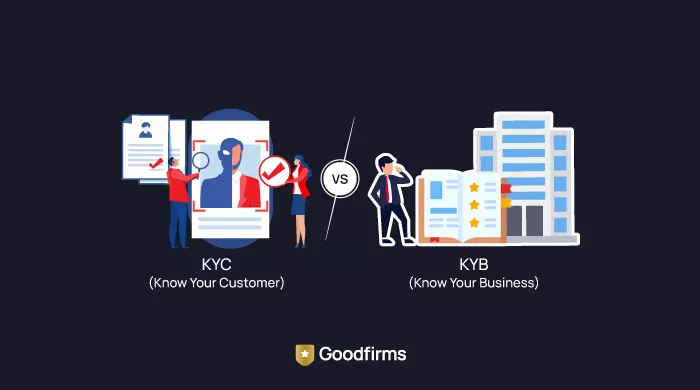
Top KYC & KYB Software Providers for Neobanks in 2026
Discover the top KYC & KYB software providers for neobanks in 2026. Compare features, pricing, and AI-driven identity verification tools to ensure secure... ... Read research article