Best GIS Software
Demographic data is key to any business today. Knowing where your customers come from, understanding your peak business location, and unleashing the hidden opportunities are critical to surviving in a competitive business setting. A geographic information system software or a GIS system is capable of gathering and analyzing information effortlessly. GIS mapping software encompasses various functional features that integrate different sets of data. An efficient GIS tool can reveal more in-depth insights into the data by drawing multiple patterns, and predictive models enabling users to make better and smarter decisions. The following list of GIS software solutions includes some of the best GIS Software available in the market.
List of Geographic Information System (GIS) Software | Best GIS Mapping Software
-
![MapWindow]()
The MapWindow GIS project includes a free and open-source desktop geographic information system (GIS) with an extensible plugin architecture, a GIS ActiveX control, and C# GIS programmer library called DotSpatial. We would ... read more about MapWindow
Entry Level PriceFree versionFree TrialAvailablePricing TypeFree100% in GIS SoftwareFeatures
- Colour Coding
- Data Analysis
- Geo-coding
- Labeling
- Mapping Tools
- Spatial Analysis
Key Details
Licensing & Deployment
-
On Premises
-
Web-based
-
Windows
Knowledge Base
-
Help Guides
-
On-Site Training
Packages
Pricing Type
-
Free
Payment Frequency
-
Free
-
![DIVA-GIS]()
DIVA-GIS is a free computer program for mapping and geographic data analysis (a geographic information system (GIS). With DIVA-GIS you can make maps of the world, or of a very small area, ... read more about DIVA-GIS
Entry Level PriceFree versionFree TrialAvailablePricing TypeFree100% in GIS SoftwareFeatures
- Colour Coding
- Data Analysis
- Geo-coding
- Image Management
- Labeling
- Mapping Tools
- Navigation Services
- Spatial Analysis
Key Details
Licensing & Deployment
-
On Premises
-
Web-based
-
Windows
Knowledge Base
-
Help Guides
Packages
Pricing Type
-
Free
Payment Frequency
-
Free
-
![SafeCityGIS]()
We help build safer, more informed, and smarter communities with data-driven intelligence. SafeCityGIS provides customized leading-edge technological advancements for public safety agencies. The power of our GIS software, combined with Esri applications, ... read more about SafeCityGIS
Entry Level PriceContact vendorFree TrialN/APricing TypeContact Vendor100% in GIS SoftwareFeatures
- 3D Visualization
- Colour Coding
- Data Analysis
- Geo-coding
- Mapping Tools
- Navigation Services
- Spatial Analysis
Key Details
Licensing & Deployment
-
Cloud Hosted
-
Web-based
Support
- Phone
Knowledge Base
-
Help Guides
-
Video Guides
-
Blogs
-
Webinars
Packages
Pricing Type
-
Contact Vendor
Free Version
-
No
Payment Frequency
-
Quote Based
-
![Esri]()
Whether police departments are analyzing crime patterns, managing special operations, or on patrol, smart maps can help law enforcement agencies keep your community safe. Geographic information system (GIS) maps make information actionable. ... read more about Esri
Entry Level PriceContact vendorFree TrialN/APricing TypeContact Vendor100% in GIS SoftwareFeatures
- 3D Visualization
- Data Analysis
- Geo-coding
- Mapping Tools
- Spatial Analysis
Key Details
Licensing & Deployment
-
Cloud Hosted
-
Web-based
Support
- Phone
Knowledge Base
-
Help Guides
-
Video Guides
-
Blogs
-
Webinars
Packages
Pricing Type
-
Contact Vendor
Free Version
-
No
Payment Frequency
-
Quote Based
-
![CSV2GEO]()
CSV2GEO provides live conversion of worldwide batch addresses into geographic coordinates (address to lat long) or turn coordinates into a well-formatted address It creates and publishes interactive maps.
Entry Level PriceFree versionFree TrialAvailablePricing TypeFree100% in GIS SoftwareFeatures
- Data Analysis
- Geo-coding
- Labeling
- Mapping Tools
- Navigation Services
- Remote Sensing
Key Details
Licensing & Deployment
-
Cloud Hosted
-
On Premises
-
Web-based
-
iPhone/iPad
-
Android
-
Windows
-
Mac
-
Linux
Support
- Chat
- Phone
Knowledge Base
-
Help Guides
-
Video Guides
-
Blogs
-
On-Site Training
Packages
Pricing Type
-
Free
Payment Frequency
-
Monthly Payment
-
Annual Subscription
-
Quote Based
-
One-Time Payment
-
Free
-
![Asset Essentials]()
Brightly, a Siemens company, the global leader in intelligent asset management solutions, enables organizations to transform the performance of their assets. Brightly’s sophisticated cloud-based platform leverages more than 20 years of data ... read more about Asset Essentials
Entry Level PriceContact vendorFree TrialN/APricing TypeContact Vendor15% in GIS SoftwareFeatures
- Colour Coding
- Geo-coding
- Labeling
- Mapping Tools
Key Details
Industries
-
Facilities-services
Licensing & Deployment
-
Proprietary
-
Cloud Hosted
-
Web-based
-
iPhone/iPad
-
Android
Support
- Chat
- Phone
-
24x7 Support
Training
-
Webinar
Knowledge Base
-
Help Guides
-
Video
-
Blog
-
Webinar
Packages
Pricing Type
-
Contact Vendor
Preferred Currency
-
USD ($)
Free Version
-
No
Payment Frequency
-
Quote Based
-
![Base]()
If you can dream it, Base can map it! Base enables you to create a fully customizable store or product locator map in minutes. Our simple copy and paste integration works with ... read more about Base
Entry Level PriceContact vendorFree TrialN/APricing TypeContact Vendor50% in GIS SoftwareFeatures
- Colour Coding
- Geo-coding
- Labeling
- Mapping Tools
Key Details
Licensing & Deployment
-
Cloud Hosted
-
Web-based
Support
- Phone
Knowledge Base
-
Help Guides
-
Video Guides
-
Blogs
-
Webinars
Packages
Pricing Type
-
Contact Vendor
Free Version
-
No
Payment Frequency
-
Quote Based
-
![Mapline]()
Mapline can help to quickly convey information using dynamic pins. Automatically set colors, shapes, sizes, add labels based on data from your spreadsheet. Heat mapping offers a variety of solutions, including territory-based ... read more about Mapline
Entry Level PriceContact vendorFree TrialN/APricing TypeContact Vendor50% in GIS SoftwareFeatures
- Data Analysis
- Geo-coding
- Labeling
- Mapping Tools
- Navigation Services
- Spatial Analysis
Key Details
Licensing & Deployment
-
Cloud Hosted
-
Web-based
Knowledge Base
-
Help Guides
-
Video Guides
-
Blogs
Packages
Pricing Type
-
Contact Vendor
Free Version
-
No
Payment Frequency
-
Monthly Payment
-
![GeoViewer Online]()
Managing many stand-alone systems is hard. Paper based systems are cumbersome, work intensive, often unorganized, and inefficient. GeoViewer Online unifies these areas of your operations, from managing work orders, maintaining assets, reducing ... read more about GeoViewer Online
Entry Level PriceContact vendorFree TrialN/APricing TypeContact Vendor20% in GIS SoftwareFeatures
- 3D Visualization
- Colour Coding
- Data Analysis
- Image Management
- Labeling
- Mapping Tools
- Navigation Services
- Remote Sensing
- Spatial Analysis
Key Details
Industries
-
Facilities-services
-
Logistics-supply-chain
-
Transportation-trucking-railroad
Licensing & Deployment
-
Proprietary
-
Cloud Hosted
-
Web-based
-
iPhone/iPad
-
Mac
Support
- Email
- Phone
-
24x7 Support
Knowledge Base
-
Help Guides
-
Video
-
Infographics
Packages
Pricing Type
-
Contact Vendor
Preferred Currency
-
USD ($)
Free Version
-
No
Payment Frequency
-
Quote Based
-
![neo360]()
neo360 is a geo-analytics platform by Lepton Software that helps telecom companies unlock the power of their data to understand their customers better and optimize their network flow. It is imperative that ... read more about neo360
Entry Level PriceContact vendorFree TrialAvailablePricing TypeFlat Rate100% in GIS SoftwareFeatures
- 3D Visualization
- Data Analysis
- Mapping Tools
- Spatial Analysis
Key Details
Industries
-
Telecommunications
Licensing & Deployment
-
Proprietary
-
Cloud Hosted
-
On Premises
-
Web-based
Support
- Email
- Chat
- Phone
-
24x7 Support
Training
-
Webinar
-
In-person
-
Documentation
Packages
Pricing Type
-
Flat Rate
Preferred Currency
-
INR (₹)
Free Version
-
Yes
Free Trial
-
Available Trial
Payment Frequency
-
Annual Subscription
-
Quote Based
-
![Urban SDK]()
Urban SDK is an urban data analytics platform that provides State and Local Governments with a transportation information system of record for traffic diagnostics, data management, and compliance tools to share information ... read more about Urban SDK
Entry Level PriceContact vendorFree TrialN/APricing TypeContact Vendor50% in GIS SoftwareFeatures
- 3D Visualization
- Data Analysis
- Geo-coding
- Mapping Tools
- Navigation Services
- Remote Sensing
Key Details
Industries
-
Architecture-planning
-
Transportation-trucking-railroad
Licensing & Deployment
-
Proprietary
-
On Premises
-
Web-based
Support
- Chat
-
Weekdays
Training
-
Webinar
-
Documentation
Packages
Pricing Type
-
Contact Vendor
Preferred Currency
-
USD ($)
Free Version
-
No
Payment Frequency
-
Monthly Payment
-
Annual Subscription
-
Quote Based
-
One-Time Payment
-
![Maps and Apps Cloud]()
MnA Cloud is a one-stop shop for anything/anyone concerned with GIS; composed of three pillars. MnA Cloud edition’s mission is to bring the value of GIS to those unaware of its impact ... read more about Maps and Apps Cloud
Entry Level PriceContact vendorFree TrialN/APricing TypeFlat Rate100% in GIS SoftwareFeatures
- 3D Visualization
- Colour Coding
- Data Analysis
- Geo-coding
- Image Management
- Labeling
- Mapping Tools
- Navigation Services
- Remote Sensing
- Spatial Analysis
Key Details
Industries
-
Government-administration
-
Nonprofit-organization-management
Licensing & Deployment
-
Proprietary
-
Cloud Hosted
-
Web-based
Support
- Email
- Chat
- Phone
-
24x7 Support
Training
-
Webinar
-
In-person
-
Documentation
Packages
Pricing Type
-
Flat Rate
Preferred Currency
-
USD ($)
Free Version
-
Yes
Payment Frequency
-
Annual Subscription
-
![Flightmapper.io]()
Flightmapper.io is an innovative online tool that transforms your flight data into visually stunning maps and animations. Designed for both aviation enthusiasts and frequent travelers, it allows you to track, analyze, and ... read more about Flightmapper.io
Entry Level Price$8.99 Per MonthFree TrialN/APricing TypePer User50% in GIS SoftwareFeatures
- 3D Visualization
- Data Analysis
- Geo-coding
- Mapping Tools
- Navigation Services
Key Details
Industries
-
Airlines-aviation
-
Aviation-aerospace
-
Design
Licensing & Deployment
-
Proprietary
-
Cloud Hosted
-
Web-based
Support
- Email
-
24x7 Support
Training
-
Documentation
Knowledge Base
-
Video Flight Maps
-
Map Images
Packages
Pricing Type
-
Per User
Preferred Currency
-
USD ($)
Free Version
-
Yes
Payment Frequency
-
Monthly Payment
-
Annual Subscription
Available Packages
Standard$8.99 Per Month -
![Aakashe]()
Aakashe is an instant drone imagery platform based in India. The subscription-based solution provides high-resolution aerial data to customers in infrastructure, urban planning, and real estate sectors. Key features include instant drone ... read more about Aakashe
Entry Level PriceContact vendorFree TrialN/APricing TypeUsage Based80% in GIS SoftwareFeatures
- Data Analysis
- Geo-coding
- Image Management
- Labeling
- Mapping Tools
- Navigation Services
- Spatial Analysis
Key Details
Industries
-
Architecture-planning
-
Civil-engineering
-
Construction
-
Defense-space
-
Government-administration
Licensing & Deployment
-
Proprietary
-
Cloud Hosted
-
Web-based
-
iPhone/iPad
-
Android
-
Windows
-
Mac
-
Linux
Support
- Email
- Chat
- Phone
-
24x7 Support
Training
-
Webinar
-
In-person
Packages
Pricing Type
-
Usage Based
Preferred Currency
-
INR (₹)
Free Version
-
Yes
Payment Frequency
-
Monthly Payment
-
Annual Subscription
-
Quote Based
Integration
Integrated With
- ArcGIS
- QGIS
- AutoCAD
-
![Swyvl]()
Swyvl began as a vision shared by co-founders Alex and Laura Tolson, stemming from their decade-long experience as Google Trusted Photographers. Over the past 10 years, their 360 photos garnered over 45 ... read more about Swyvl
Entry Level PriceContact vendorFree Trial14 DaysPricing TypePer User25% in GIS SoftwareFeatures
- 3D Visualization
- Colour Coding
- Data Analysis
- Image Management
- Labeling
- Mapping Tools
Key Details
Industries
-
Architecture-planning
-
Civil-engineering
-
Commercial-real-estate
-
Construction
-
Defense-space
-
Environmental-services
-
Events-services
-
Facilities-services
-
Farming
-
Insurance
-
Mining-metals
-
Oil-energy
-
Real-estate
-
Utilities
Licensing & Deployment
-
Proprietary
-
Cloud Hosted
-
Web-based
Support
- Email
-
24x7 Support
Packages
Pricing Type
-
Per User
Preferred Currency
-
USD ($)
Free Version
-
No
Free Trial
-
14 Days Trial
Payment Frequency
-
Monthly Payment
-
![Picarta]()
Picarta is a powerful AI tool that identifies where any photo was taken by analysing visual content. Just upload an image, and Picarta returns accurate GPS coordinates—no metadata needed. Whether it’s a ... read more about Picarta
Entry Level PriceContact vendorFree TrialAvailablePricing TypeUsage Based80% in GIS SoftwareFeatures
- Data Analysis
- Mapping Tools
- Spatial Analysis
Key Details
Industries
-
Computer-software
-
Law-enforcement
-
Photography
-
Research
Licensing & Deployment
-
Proprietary
-
Cloud Hosted
-
On Premises
-
Web-based
Support
- Email
- Chat
-
24x7 Support
Training
-
Documentation
Packages
Pricing Type
-
Usage Based
Preferred Currency
-
USD ($)
Free Version
-
Yes
Payment Frequency
-
Monthly Payment
-
One-Time Payment
-
![Mapme]()
In a GIS context, Mapme serves as a presentation and engagement layer for spatial data, enabling teams to publish, visualize, and share geographic information with non-technical audiences, without coding. While traditional GIS ... read more about Mapme
Entry Level Price$30 Per MonthFree Trial14 DaysPricing TypeFlat Rate100% in GIS SoftwareFeatures
- 3D Visualization
- Colour Coding
- Labeling
- Mapping Tools
Key Details
Industries
-
Commercial-real-estate
-
Construction
-
Events-services
-
Government-administration
-
Leisure-travel
-
Marketing-advertising
-
Nonprofit-organization-management
-
Real-estate
-
Retail
Licensing & Deployment
-
Proprietary
-
Cloud Hosted
-
Web-based
Support
- Chat
-
24x7 Support
Training
-
In-person
-
Documentation
Knowledge Base
-
Knowledgebase
Packages
Pricing Type
-
Flat Rate
Preferred Currency
-
USD ($)
Free Version
-
Yes
Free Trial
-
14 Days Trial
Payment Frequency
-
Monthly Payment
-
Annual Subscription
Available Packages
Starter$30 Per MonthProfessional$55 Per MonthExpert$110 Per MonthIntegration
Integrated With
- Google Sheets
- Google Form
- crm tools
- jot form


- 1
- 2
Why Trust Goodfirms
Goodfirms is the world’s leading reviews and ratings company featuring 110,000+ tech companies from across the globe, complete with 80,000+ humanly vetted client reviews, detailed portfolios, hourly rates, employee strength, and more to help you choose your perfect tech partner.
Humanly-Vetted Client Reviews
Our researchers have personally vouched for the authenticity of 80,000+ client reviews by speaking directly with clients, cross-checking project details, timelines, and results to ensure 100% credibility.
Data-Driven Rankings
Data powers our company listings. Every company listed is evaluated based on its expertise, experience, market presence, reviews, and client satisfaction rate, which helps buyers confidently choose the right tech partner.
Global Trust & Recognition
Goodfirms is trusted by 110,000+ businesses in 160+ countries to connect with reliable tech partners. Our reputation is built on 80,000+ verified reviews and rankings you can trust.
Transparency In Detail
From verified client reviews and portfolio highlights to service focus and pricing, Goodfirms provides a 360-degree view of every company, helping 2+ million monthly users find the perfect tech partner.
Trending insights from Goodfirms
Valuable insights from top experts accelerate decision-making.

How Is GIS Used in Weather-Driven Business Analytics?
This blog discusses the interesting uses of GIS in weather-driven business analytics. Read more to find out how to leverage GIS software for your business. ... Read research article
IT Management Software Comparison 2026: 12 Platforms Enterprise Teams Actually Use
Which IT management software is best in 2026? Compare 12 platforms by TCO, AI capabilities, and real enterprise use cases. Find the right ITSM, ITOM, or... ... Read research article
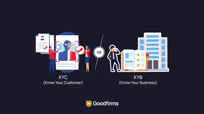
Top KYC & KYB Software Providers for Neobanks in 2026
Discover the top KYC & KYB software providers for neobanks in 2026. Compare features, pricing, and AI-driven identity verification tools to ensure secure... ... Read research article