Overview:
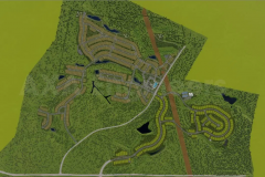
Spanning 600 acres and comprising 777 lots, the project is situated on undulating slopes interspersed with flood-prone areas, stream buffers, and an established electrical transmission network. AXA Engineers, in collaboration with our partners, was entrusted with this project after it had already undergone review by several other consulting firms without approval. This complex project necessitated a high level of determination and innovative problem-solving to navigate the myriad challenges presented by the site’s topography and existing infrastructure.Utilizing Autodesk’s suite of advanced tools such as Civil 3D, Infraworks, SSA Vehicle Tracking, and Dynamo, we approached the project with a phased construction strategy. This allowed us to address arising issues and make timely adjustments while maintaining clear communication with stakeholders. For instance, the use of Infraworks facilitated the preliminary design and geometric planning of roadways, while SSA was instrumental in optimizing stormwater management systems for the vast area.
The project began with the southern region (South 123), where we built upon preliminary client designs, followed by the more complex northern region (North). The final phase involved the simultaneous development of South 456 and the North to ensure seamless connectivity and project efficiency.
Throughout each phase, we prioritized minimizing environmental impact by adhering to strategic water management solutions and ecological preservation standards. The use of grading optimization and 3D modeling in Civil 3D enhanced our ability to visualize and mitigate potential environmental disruptions. Each step of the process was underpinned by a commitment to sustainability and innovative design, ensuring that the project not only meets client requirements but also contributes positively to the community and the environment.
Describe the business and/or technical challenges of this project:
1. Complex Terrain and Flood-Prone Areas:The project site featured undulating slopes interspersed with regions susceptible to inundation. These conditions required careful planning and strategic water management solutions to mitigate flood risks and ensure structural stability.
2. Stringent Regulatory Compliance:Adhering to environmental regulations and preserving ecological zones was paramount. The presence of stream buffers and flood-prone areas necessitated compliance with strict environmental regulations, demanding meticulous planning and execution to avoid ecological disruptions.
3. Phased Construction Approach:Given the project’s vast scope, a phased construction approach was necessary. Coordinating different sections independently while maintaining overall project cohesion presented significant logistical challenges.
4. Water Management and Drainage:Designing an efficient stormwater management system was crucial due to the site’s extensive size and varied topography. Effective management of stormwater runoff and flood-prone areas added to the complexity of the project.
5. Terrain Grading and Earthwork Balancing:The hilly terrain posed a challenge for earthwork operations. Balancing cut-and-fill volumes to optimize construction costs and minimize environmental impact required detailed planning and continual adjustments.
6. Utility Coordination:Ensuring proper spacing and alignment of various utility systems (storm, sewer, water, fire mains) to avoid conflicts and adhere to safety standards was critical. This included maintaining safe distances from other infrastructure elements.
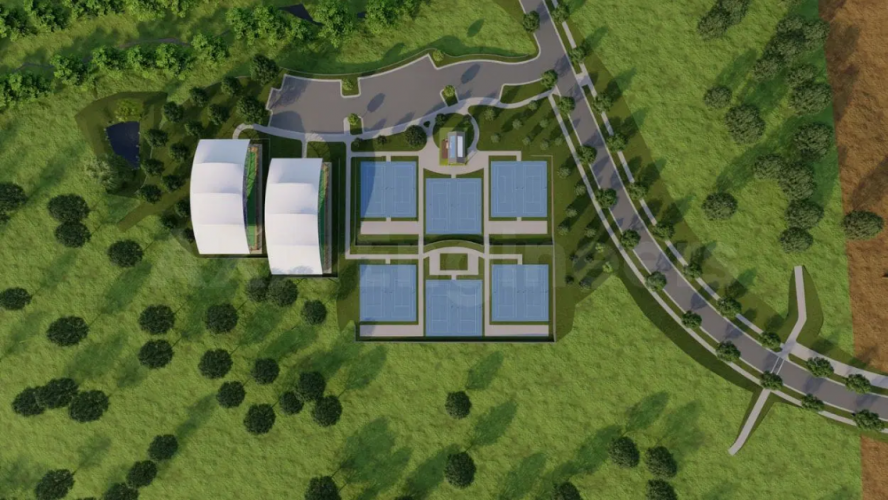
7. Vehicle Movement and Access:Planning efficient and safe transportation routes for both construction and future community use was essential. This required detailed analysis and design to accommodate vehicle movement throughout the site.
To Over These Challenges:
1. Complex Terrain and Environmental Constraints: Civil 3D’s 3D modeling capabilities allowed us to visualize and analyze the project’s challenging topography. Detailed models enabled accurate earthwork planning, balancing cut-and-fill operations to minimize environmental impact and optimize costs. Dynamo has empowered us to streamline repetitive tasks and develop customized tools, resulting in a substantial increase in our productivity and precision.
2. Regulatory Compliance and Ecological Preservation: Using Civil 3D and Grading tools, we integrated GIS data to create comprehensive visualizations of the project area. This helped identify and address regulatory and ecological issues early. Simulating different grading scenarios allowed us to meet stringent environmental regulations while preserving natural landscapes.
3. Phased Construction and Communication: The Autodesk Construction Cloud facilitated continuous communication and collaboration across all project phases. Real-time updates, issue tracking, and document sharing ensured stakeholders were informed and aligned, streamlining the phased construction process.
4. Water Management and Drainage Solutions: SSA tools provided advanced hydraulic simulations for designing efficient stormwater systems. These tools optimized pipe networks, reducing costs and environmental impacts by accurately predicting water flow and storage needs.
5. Terrain Grading and Earthwork Balancing: Civil 3D’s Grading Optimization automated grading designs, balancing excavation and fill volumes to reduce material movement and costs. Quick iterations of grading scenarios achieved optimal designs meeting client specifications and environmental constraints.

 United States