XZ Reality Capture
XZ Reality Capture
XZ Reality Capture: Precision 3D Scanning & As-Built Services
XZ Reality Capture is a premier provider of high-accuracy digital twin solutions, 3D laser scanning, and professional drone services headquartered in Texas. We specialize in transforming physical environments into precise, actionable digital assets for architects, engineers, and construction professionals. Our mission is to eliminate the "uncertainty gap" in the AEC industry by providing a single source of truth for existing site conditions.
Our Core Expertise
We leverage state-of-the-art LiDAR and Photogrammetry technologies to deliver comprehensive documentation for complex projects. Our primary service pillars include:
-
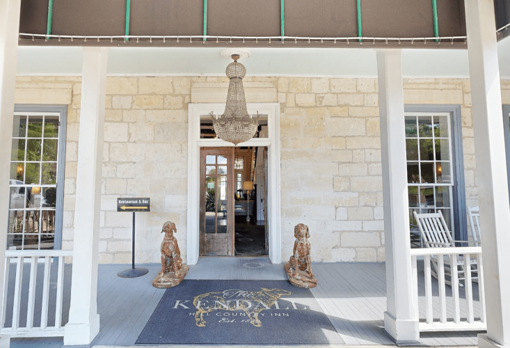
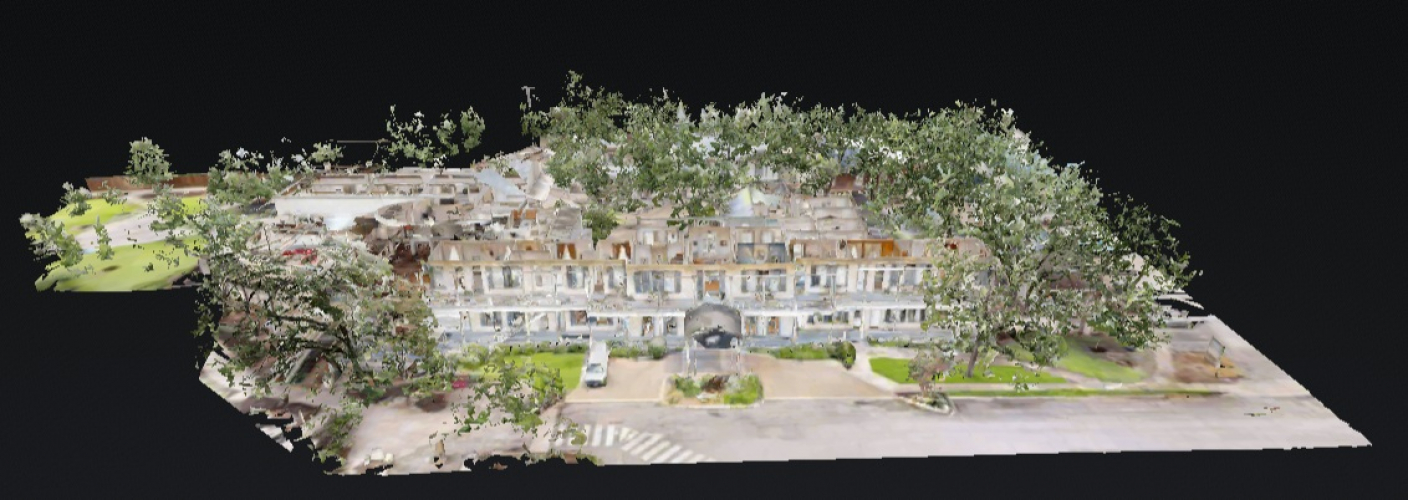
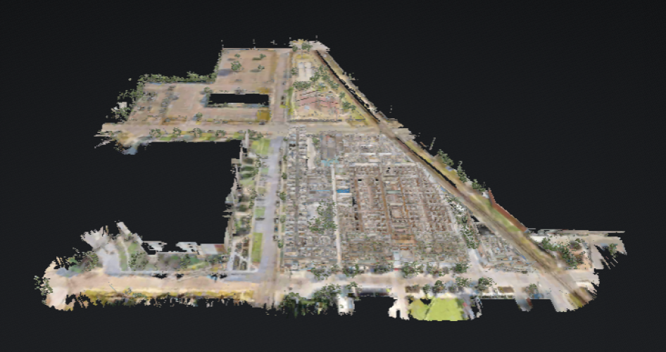
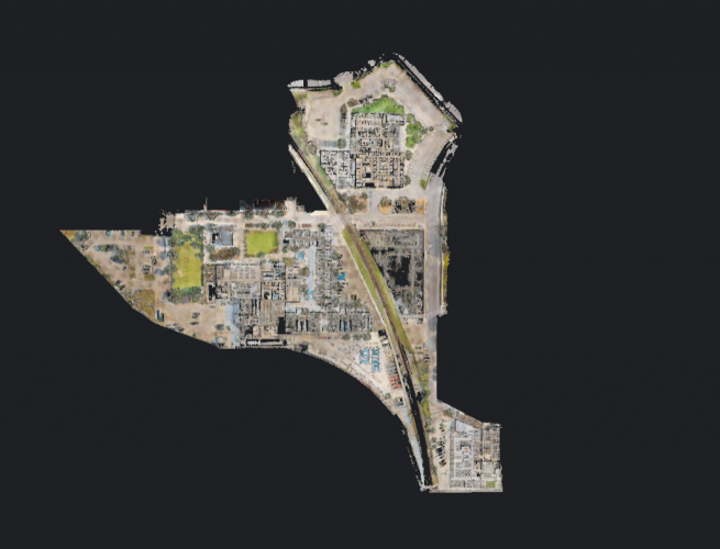
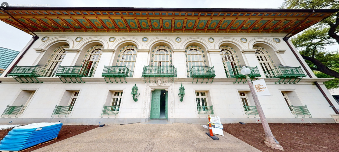
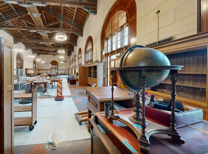
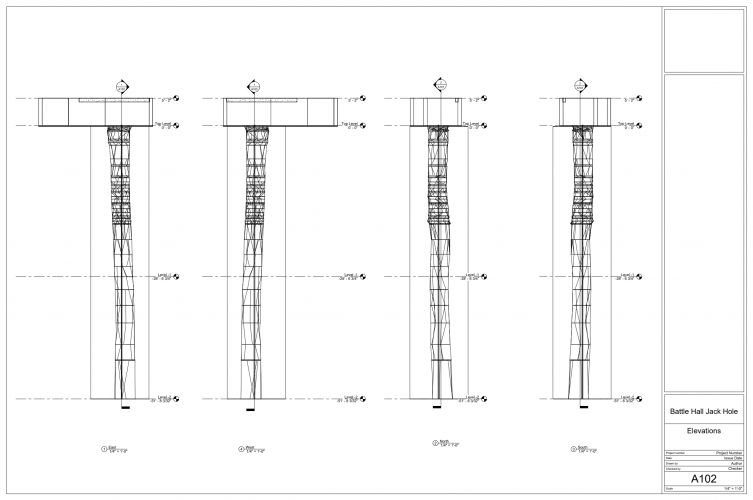
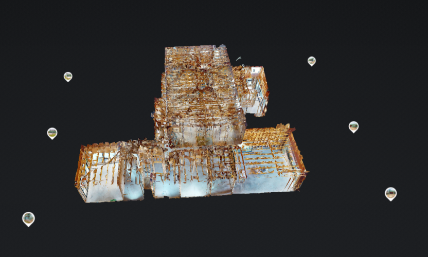
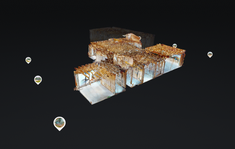
Terrestrial 3D Laser Scanning: We capture millions of data points to create dense Point Clouds with sub-millimeter accuracy. This is essential for MEP coordination, structural analysis, and historical preservation.
-
Drone & Aerial Mapping: Our FAA-certified pilots provide high-resolution aerial reality capture. From topographic surveys and volumetric calculations to large-scale site mapping, we provide data that traditional surveying cannot match.
-
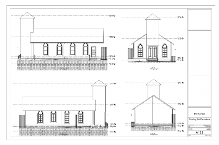
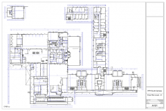
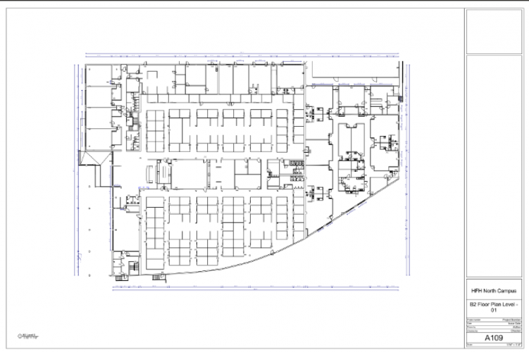
As-Built Documentation & BIM: We translate raw scan data into AutoCAD (2D) and Revit (3D BIM). Our team specializes in Scan-to-BIM workflows, ensuring your design starts with a 100% accurate representation of reality.
The Texas Advantage
Strategically positioned to serve Houston, Dallas-Fort Worth, Austin, and San Antonio, XZ Reality Capture understands the unique demands of the Texas building landscape. Whether it is a mission-critical data center, a sprawling industrial facility, or a historic renovation, we provide local expertise with national-standard technology.
Why AEC Leaders Choose XZ Reality Capture
In an era of digital transformation, we serve as a strategic partner to our clients. Our workflows are optimized to:
-
Reduce Rework: Identify clashes and structural deviations before construction begins.
-
Accelerate Timelines: Provide rapid-turnaround floor plans and 3D models.
-
Enhance Safety: Utilize remote sensing to capture data in hazardous or hard-to-reach areas.
Innovating for the Future
XZ Reality Capture is a technology partner. As the industry moves toward Digital Twins and AI-driven site analytics, we ensure our clients' data is future-proof. By providing engineering-grade reality capture, we empower stakeholders to make informed decisions throughout the entire building lifecycle.
Experience the precision of reality. Partner with XZ Reality Capture for your next project.
 United States
Why XZ Reality Capture?
- High-accuracy LiDAR & Scan-to-BIM experts.
- Reliable FAA-certified drone & 3D mapping.
- Sub-millimeter precision for AEC projects.
AI Tools & Purpose
Operations Optimization and Coding
Content Optimization and Market Research
General Searches and Market Research
Detailed Reviews of XZ Reality Capture

Client Portfolio of XZ Reality Capture
Project Industry
- Real Estate - 50.0%
- Hospitality - 25.0%
- Designing - 25.0%
Major Industry Focus
Project Cost
- $0 to $10000 - 50.0%
- $10001 to $50000 - 50.0%
Common Project Cost
Project Timeline
- 1 to 25 Weeks - 100.0%
Project Timeline
Clients: 11
- OxBow
- QA Services
- Home Depot
- Academy Sports
- Whole Foods
- Haven for Hope
- University of Texas
- Monticello Homes
- Dollar General
- Kroger
- Visiting Media
Portfolios: 4

.jpg)